
Join over 15,000 people who receive our newsletter.
Sign up to hear about cycling projects and events.
Join thousands of Sydneysiders who get around by bike each day.
Use our map, take a course or get a free bike tune-up to get started.
Learn more about the new pop up cycleways being built across Sydney.
Transport & parking
Get personalised advice and tips on bike ridingTransport & parking
Book a free guided bike ride or cycling lessonLists, maps & inventories
Sydney cycling mapLists, maps & inventories
Bike hire, shops and pumpsTalks, courses & workshops
Cycling coursesWalks and rides
Self-guided ridesBuilding new infrastructure
Creating pop-up cycleways in SydneyTransport & parking
Request a new bike parking space or find an existing oneWhat’s On
Bike Buddies 1-on-1 guided rides and cycling skills What’s On
Guided Ride - Prince Alfred Park to Marrinawi CoveWhat’s On
Free bike tune ups: Surry HillsWhat’s On
Guided ride: Central to Barangaroo - Vivid TwilightWhat’s On
Explore the Glebe to Ultimo cyclewayWhat’s On
Guided Ride: Vivid Twilight to FiretalkWhat’s On
Guided Ride - Newtown to Darlinghurst LoopWhat’s On
Bike care and maintenance courseWhat’s On
Cycling in the city: rusty riders courseWhat’s On
Cycling in the city course What’s On
The Big Bike Film Night 2025

Lists, maps & inventories
News
Oxford Street west cycleway one step closer
News
Families saddle up and ride on Sydney’s cycleways 
News
Our tips for a safe and enjoyable ride to campus
News
People of Sydney’s cycleways: Ranmalie
News
Wheels in motion for safer cycling on busiest bike route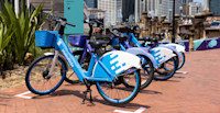
News
New designated parking zones for share bikes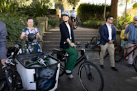
News
In pictures: Top cycling moments of 2023 
News
Why this Sydney area is very popular with people who ride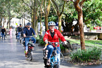
News
Explore Sydney on an e-bike 
News
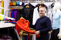
Singing the praises of an unsung City of Sydney heroSign up to hear about cycling projects and events.


