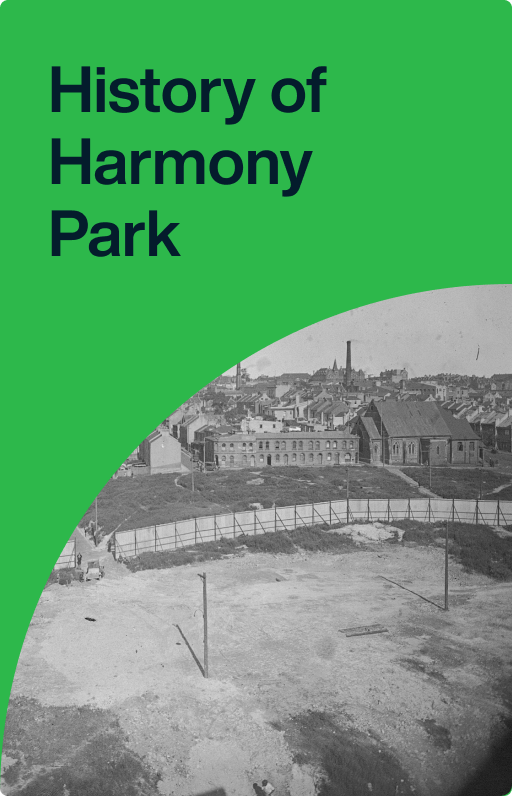
History of Harmony Park
Part of the Brisbane Street slum clearance of 1924. After decades of neglect, the area was converted to a car park and finally a park in 2006.
Harmony Park is in Brisbane Street between Hunt and Goulburn streets, Surry Hills.
The naming of Surry Hills occurred in 1792, when NSW Corps paymaster Captain Joseph Foveaux received a land grant of 100 acres just south of the limits of Sydney town.
The area was ‘locked up’ until the Riley Estate was broken up in the 1840s, and the main streets (including Foveaux and Riley streets) cut through its shifting sand hills. From then onwards Surry Hills, like other suburbs surrounding Sydney city, saw rapid development of housing mainly in terraces. Within 50 years the slide from model new estate to over-crowded slum was complete.
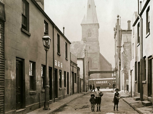
In 1905 the Sydney Municipal Council began slum clearance using road widening as one of the excuses. One of the first streets to go was Wexford Street, linking Goulburn and Elizabeth streets. Narrow, congested Wexford Street housed large numbers of Sydney’s Chinese community and in those days newspapers showed no hesitation in heaping contempt on them, with lurid stories of opium dens, gambling hells and brothels staffed by kidnapped white girls.
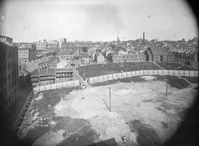
Brisbane Street’s turn for slum clearance came in 1924, when the houses and the network of narrow streets were swept away. Council planned to sell the land for warehouses on 50-year leases, but at the first sale in 1928 not one block was sold. Then the Great Depression struck and most of the 7½ acres lay empty for decades. The NSW Government bought the site in 1954 and used the future park site for car parking, later building the Sydney Police Centre to the east.
This site was bought back by Council in 2001 to create a new park. It was known as Surry Hills Park until its opening in 2006, when it was officially named Harmony Park in recognition of the site’s history and the cultural and social diversity of Surry Hills and Darlinghurst. The park is watered by stormwater which is collected from the roof of the adjoining electricity substation in a 240,000 litre tank.
Further reading
Christopher Keating, ‘Surry Hills: the city’s backyard’, Hale and Iremonger, Sydney, 1991
Spackman and Mossop, ‘Plan of Management for Surry Hills Park’, 2004.