Floodplain management
Plans to safeguard flood-prone areas across 8 local catchments covering 2,666ha.
Flooding in our local area
When it rains, water flows over the ground and along kerbs until it reaches a drainage pit. Sometimes, water flows wider than the gutter onto the footpath but stays on the road. After rain, puddles or ponding may form in depressions on the road or in parks. While inconvenient, this is normal and it’s not considered flooding.
Generally, once surface water is more than 15cm deep it may be flooding.
In built up areas like Sydney, flooding occurs after intense rain. Our drainage pits and pipes have a limited role under intense rainfall. Water must then flow overland to our waterways. This can lead to surface water entering properties. Heavy or prolonged rain may also cause creeks or canals to overflow. Unusually high sea levels can cause flooding along foreshore areas.
Floods vary significantly based on how much, how long and where rain falls. We map and track flooding in our area to understand its impact on homes and businesses, including potential water levels.
Under the NSW Government's flood prone land policy, each catchment must have its own floodplain management plan. These plans cover the 8 catchments in the City of Sydney local area.
Catchments
Flood studies
Flood planning must be reviewed every 5 years. A flood study is the first step.
These studies map flooding and identify at-risk areas in a catchment. Technical investigations help us understand the impact of updated rainfall patterns, changes within catchments and the impact of climate change.
New computer technology simulates floods to find the extent, speed, level and flow of rainfall. The new data, combined with community feedback, is used to validate and calibrate these models and to update flood maps and floodplain management plans.
Future flood studies include:
- Darling Harbour catchment – Flood study update late 2024–2026
- Sydney City catchment – Flood study update late 2024–2026
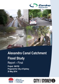
- Alexandra Canal catchment – Floodplain risk management study and plan update 2025–2027
- Centennial Park catchment – Floodplain risk management study and plan update 2025–2027
- Woolloomooloo catchment – Floodplain risk management study and plan update 2026–2028
- Rushcutters Bay catchment – Floodplain risk management study and plan update 2026–2028
- Darling Harbour catchment – Floodplain risk management study and plan update 2027–2029
- Sydney City catchment – Floodplain risk management study and plan update 2027–2029
- Blackwattle Bay catchment – Flood risk management study and plan update 2028–2030
- Johnstons Creek catchment – Flood risk management study and plan update 2028–2030
Floodplain Risk Management Advisory Panel
The Floodplain Risk Management Advisory Panel assists the City of Sydney in developing and implementing flood risk management plans by contributing ideas, professional expertise, experience and local knowledge. Its members include councillors, technical experts, government agency consultants and community members.
Community members are selected through a competitive expression of interest process. The panel was established in 2024 and will operate until 2028. It usually meets around 4 times a year.
Flood notations
All Councils in NSW are required to annotate flood prone properties in a consistent way. Where a flood study identifies that a property is flood prone, the City of Sydney will directly notify the property owner.
A flood notation will be added to the planning certificate for the property, under section 10.7. This helps owners and planners ensure new developments are safe and don’t make flooding worse.
Planning certificates, known as 10.7 certificates, provide important information about flooding. They include details about a property’s zoning, planning controls, and flood risk. Flooding questions on these certificates are consistent across NSW.
Flood studies help us understand flood depths for various flood events. Floodplain risk management plans set rules for future development, to prepare for floods.
Flood planning levels for most developments are based on 1% chance of flooding each year. An extra freeboard is added to consider wind, waves and blockages. Land below this level is the flood planning area. Development controls apply to this land to manage flood risk.
Certain land uses and developments need stricter controls than the 1% flood risk. This is called the probable maximum flood and represents the worst-case flood scenario, which is very rare.
What should owners do?
Property owners aren’t required to take action. If you wish to renovate or develop, further conditions may apply to manage the impacts of flooding. This might include raising floor levels or using flood-resistant materials.
