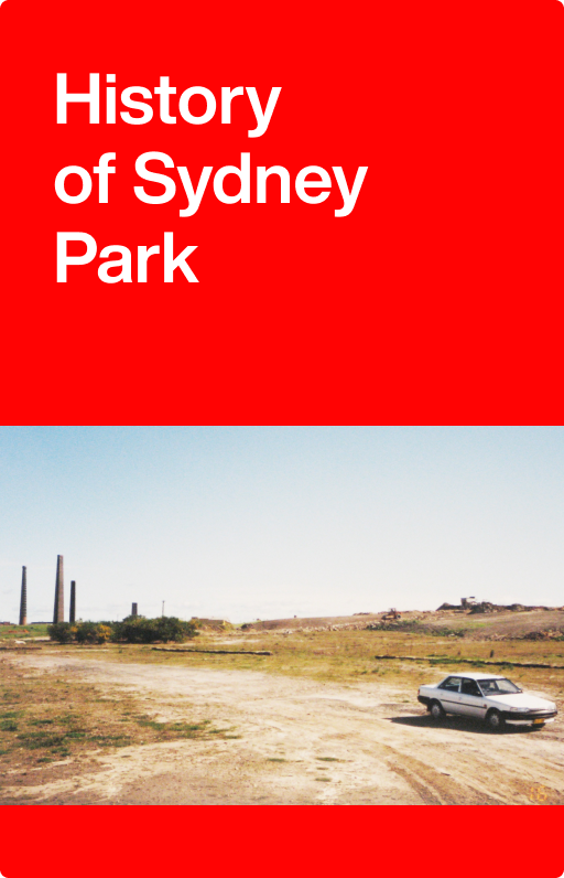
History of Sydney Park
This park is on part of a 40 acre land grant to Elizabeth Needham in 1796.
Sydney Park is bounded by the Princes Highway and Euston, Campbell, Barwon Park and Sydney Park roads.
The north-west part of the park is on the edge of a Wianamatta Shale belt from which brickmaking clay was extracted in the 19th and 20th centuries. Prior to European settlement, this area would have been a forest of turpentine and ironbark trees. The south-eastern area of the park is on Botany sands with swamps, marshes and heath associated with the waterway now known as Sheas Creek.
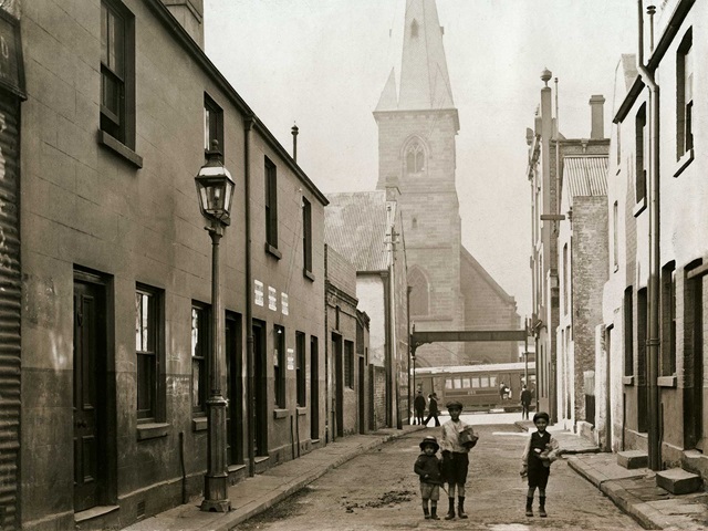
Land between Parramatta Road and the Cooks River (today’s Newtown-St Peters area, including Sydney Park), was known as the District of Bullanaming (or Bulanaming) in the beginning of the 19th century. The Newtown-St Peters area was also referred to as the ‘Kangaroo Ground’. Local Aboriginal peoples, the Gadigal and Wangal, hunted kangaroo on the grasslands here, and fished and camped at the swamps, creeks and rivers that crisscrossed the area.
It is likely that that the original road to the Cooks River, extending from Forbes Street near the University of Sydney to St Peters where it joins the Princes Highway, followed an Aboriginal track across the ridgeline through Newtown. Originally known as the Bulanaming Road and later as the Cooks River or Newtown Road, it was officially named King Street in 1877.
Sydney Park is on part of a 40 acre land grant to Elizabeth Needham in 1796.
Elizabeth Needham (nee Gore) was a First Fleet convict who later became a successful Sydney businesswoman. Recorded as both a servant and a needlewoman in her native England, she was reputedly the daughter of Lady Charlotte Finch’s coachman. Lady Finch was the Royal Governess to King George III.
Elizabeth’s first marriage was to Henry Needham in 1782. In July 1786, Elizabeth Needham was convicted for stealing 2 pairs of silk stockings worth 30 shillings and received a sentence of 7 years. She was transported to Australia on the Lady Penrhyn, arriving to Sydney in January 1788. A month later, she bigamously married William Snailham and bore him 3 children. Her second husband died in 1796. She married a third time to John Driver and they had 3 children together. Following Driver’s death in 1810, she married a fourth time to publican and dealer Henry Edward Marr.
In 1796, Elizabeth Needham’s sentence expired and she received a 40 acre land grant in her own right in the district of Bulanaming on the site of today’s Sydney Park. She also held the licence for the Wheatsheaf Inn from 1797, and later ran a warehouse and general store on Castlereagh Street. On 3 January 1825, shortly after her third return visit to England, she died at the Star and Garter Inn at Portsmouth. (Gillen, Mollie et al 1989, ‘The founders of Australia: a biographical dictionary of the First Fleet’, Library of Australian History, Sydney)
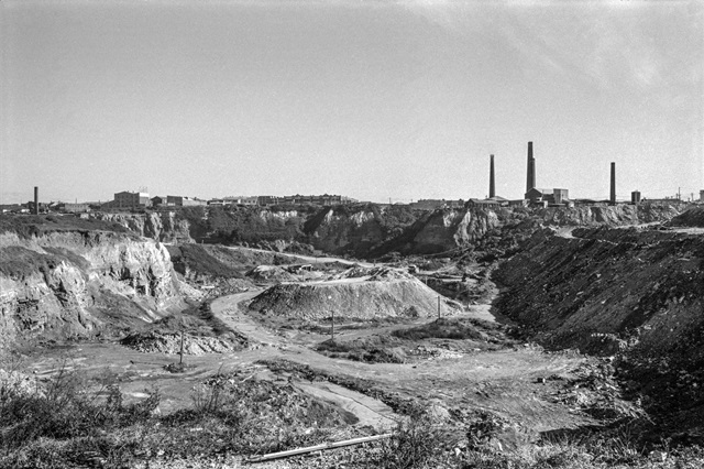

Brickworks and workers
The rich alluvial soil in the Newtown-St Peters-Alexandria area was considered ideal for gardens and orchards, as were its clay beds for pottery and brickmaking. A number of brick, pottery and tile works were established in the area from the early 19th century to exploit this readily available resource.
In 1808, Needham’s 40 acre land grant was sold to John and Gregory Blaxland. The land was purchased by Daniel Cooper in 1822, and it became part of Cooper family’s extensive landholdings in the area, known as the Waterloo estate. Several generations of the Cooper family preferred to lease rather than sell and subdivide their land in the 19th century. Portions of the former Needham grant were leased by brickmakers from the early 1880s and probably earlier.
In 1887, Josiah Gentle purchased just over 2 acres of land on the corner of the Cooks River Road (today’s Princes Highway) ‘with all buildings and rights of way’ (Land Titles Office Book 364 No 190). Gentle established the Bedford Brick Works here in 1893, naming it after his home town in England. He continued to buy up adjoining land until 1908 to expand his brickworks. Clay was extracted from the deep pits and large kilns fired it into bricks.
Gentle was one of many brickmakers living and working in the Newtown and St Peters area during the 19th century. He had immigrated to Sydney with his family from Bedfordshire in England in the 1850s. He began his brickmaking career in Waterloo with his stepfather James Rawlings, and by the 1870s was operating brickworks in Newtown and Petersham.
From 1887, Gentle began buying up land on the site of today’s Sydney Park for the Bedford Brick Works. His business survived when others did not because Gentle invested in steam-powered machinery and modern kilns. Following his death in 1912, his 3 sons carried on the business.
In 1936 Austral Brick Company bought out the Bedford Brick Works and operated on the site until 1970. Austral had operated another brickworks further south at the corner of the Princes Highway and Cowper Street since the 1880s and these continued to operate until 1983.
There were a number of Aboriginal workers employed at Austral’s St Peters Brickworks. Richard Alexander (Alec), William Donald (Don) and Adam Eatock were some of the Aboriginal employees at the brickyards in the 1920s. Later Aboriginal workers at the brickyards came from the Port Macquarie area.
From tip to tip top
In 1948, the deep clay brick-pits became a major municipal waste depot for Sydney. It was known by several names including the St Peters tip, Campbell Road Disposal Depot, Alexandria Tip, and the Disposal Depot Alexandria. Household rubbish was dumped in the former brick-pits until 1976.
Other parts of the Sydney Park site not used for brickmaking or as a rubbish tip had a range of other industrial uses including gas storage, manufacturing and warehousing.
When St Peters tip was finally closed, a final layer of soil and building rubble was placed over the former brick-pits to create a new regional park. In 1991 ownership of the Sydney Park site was transferred to South Sydney Council, and to the City of Sydney once the 2 councils merged in 2004.
Sydney Park includes a series of visually prominent hills which provide panoramic views of the city skyline and Sydney Airport. The park is popular for recreational activities such as kite flying. Stormwater detention ponds have been transformed into wetland habitat to partly recreate the pre-European environment. At the same time the area’s industrial heritage has been preserved with the kilns and brickworks chimneys at the corner of Sydney Park Road and the Princes Highway.
Alan Davidson Oval at the corner of Sydney Park Road and Euston Road was opened in 2003 and provides facilities for cricket and Australian Rules football. It is named after the all-rounder who played 44 cricket tests for Australia and was later chairman of Cricket Australia.
The AIDS Memorial Grove next to council’s plant nursery on Barwon Park Road is the result of annual community tree planting days which began in 1994.
CARES (Community and Road Education Scheme) on Sydney Park Road opened in 2004 and provides a safe place for children to learn about road safety.
Further Reading
Conybeare Morrison and Partners Pty Ltd, ‘Sydney Park Plan of Management’, 1982
EDAW (Australia) Pty Ltd, ‘Sydney Park Plan of Management’, 1995
Hall Greenland, ‘Eatock, Lucy Harriet (1874–1950)’, “Australian Dictionary of Biography”, National Centre of Biography, Australian National University, accessed 24 September 2013.
Tropman and Tropman Architects, ‘Sydney Park Brick Kiln and Chimney Precinct Heritage and Structural Assessment’, 2000
Tropman & Tropman Architects, ‘Sydney Park Brick Kilns Precinct, corner Princes Highway & Sydney Park Road, Alexandria: conservation management plan’, prepared for City of Sydney Council, 2007
Ron Ringer, 2005, interview with Bill Wheatley in ‘The BrickMasters 1788–2008’, Dry Press Publishing, Sydney, p229, cited in Cadigal Newtown – working lives
South Sydney City Council, ‘Sydney Park Amended Plan of Management’, July 2003
Reuss & Browne's map of the subdivisions in and about Sydney and environs, 1857, National Library of Australia, MAP F 108 Tile b1
Reuss & Halloran's map of Newtown brickyards leases: Needham's grant and Waterloo Estate, 1881, State Library of NSW, M2 811.1825/1881/1
Parks
Sydney ParkA multi-award-winning regional park with extensive off-leash areas, rolling hills, large playground, children’s cycle track, skate park, wetlands, sports oval and outdoor fitness areas.AlexandriaPlaygrounds
Sydney Park PlaygroundAn extensive partially enclosed playground with a diverse range of traditional and adventure play equipment for all children of all ages and abilities. The park also features a children's cycling track and skate park.Alexandria